Date Updated:
Manaslu Circuit Trek Height, Altitude, Elevation, & Length Guide
Table of Contents
- Why Manaslu Circuit Trek Altitude Demands Respect?
- Manaslu Circuit Trek Length and Distance Explained
- Understanding the Manaslu Circuit Trek Altitude
- Day-by-Day Altitude and Distance Breakdown
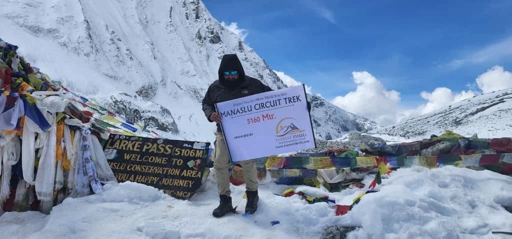
- Conquering the Highest Point: Larkya La Pass
- Weather and Temperature at Larkya La Pass
- How Long Does It Take to Cross Larkya La Pass?
- Altitude Sickness on the Manaslu Circuit: A Critical Guide
- What is Altitude Sickness?
- Acclimatization Tips for a Safe Trek
- Ready to Take on the Challenge?
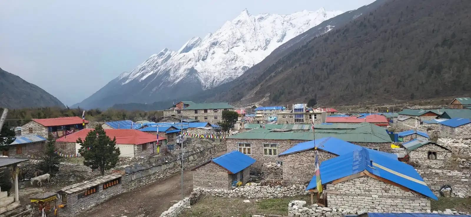
The Manaslu Circuit Trek is one of Nepal’s most spectacular high-altitude journeys, circling the majestic Mount Manaslu (8,163 m) and reaching remote villages, alpine landscapes and the dramatic Larkya La Pass. For those planning this adventure, understanding the trek’s height, altitude, elevation gain, and distance is essential for proper preparation and safe trekking.
Before we dive into the details, here are the essential metrics every trekker needs to know. This table provides a quick overview of the Manaslu Circuit Trek's most critical statistics.
| Metric | Detail |
|---|---|
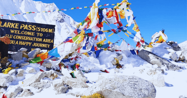
| Trek Highest Point | Larkya La Pass (5,106 meters / 16,752 feet) |
| Total Trek Distance | Approximately 177 kilometers (110 miles) |
| Average Trek Duration | 14-16 days |
| Start Point Altitude | Soti Khola (~730 meters / 2,395 feet) |
| End Point Altitude | Dharapani (~1,860 meters / 6,102 feet) |
| Major Altitude Gain | Over 4,300 meters (14,100 feet) from start to pass |
Proper altitude management requires experienced guides who understand acclimatization science and emergency protocols in remote Himalayan environments. Hence, trekking with a reliable trekking company is essential for safety.
Why Manaslu Circuit Trek Altitude Demands Respect?
These statistics define the challenges and beauty of this trek. A total elevation gain of over 4,300 meters means your body will be pushed to adapt to thinning air.
The remote nature of the Manaslu Circuit means that quick medical evacuation is not always possible, making a solid understanding of acclimatization your number one priority. This trek is a test of endurance, but the reward is an authentic and breathtaking journey around the world's eighth-highest mountain.
Manaslu Circuit Trek Length and Distance Explained
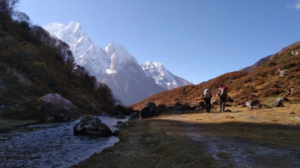
The total Manaslu Circuit Trek length is approximately 177 kilometers (110 miles) when completed on the standard 14-16 day itinerary. This total distance is typically broken down into daily segments of 6 to 8 hours of walking, covering between 10 to 22 kilometers. The Manaslu Circuit Trek distance is comparable to other classic treks but is renowned for its remote and beautiful trails. The sense of isolation and untouched beauty makes every kilometer worthwhile.
Understanding the Manaslu Circuit Trek Altitude
The Manaslu Circuit Trek elevation is not a steady climb. It's a series of ascents and descents that follow the "climb high, sleep low" acclimatization principle. A detailed day-by-day breakdown is the best way to understand the Manaslu trek elevation gain and prepare your body accordingly. You can also view the Manaslu trek map to follow the route visually.
Day-by-Day Altitude and Distance Breakdown
| Day | Route | Distance (approx.) | Altitude Gain/Loss | Night Altitude |
|---|---|---|---|---|
| 1 | Drive to Soti Khola | - | - | 730m / 2,395ft |
| 2 | Soti Khola to Machha Khola | 12 km | +200m | 930m / 3,051ft |
| 3 | Machha Khola to Jagat | 14 km | +480m | 1,410m / 4,626ft |
| 4 | Jagat to Deng | 15 km | +394m | 1,804m / 5,919ft |
| 5 | Deng to Namrung | 14 km | +826m | 2,630m / 8,629ft |
| 6 | Namrung to Samagaon | 16 km | +900m | 3,530m / 11,581ft |
| 7 | Acclimatization Day in Samagaon | - | - | 3,530m / 11,581ft |
| 8 | Samagaon to Samdo | 8 km | +330m | 3,860m / 12,664ft |
| 9 | Samdo to Dharmasala | 6 km | +600m | 4,460m / 14,632ft |
| 10 | Dharmasala to Bimthang via Larke Pass | 22 km | +700m / -1,440m | 3,720m / 12,205ft |
| 11 | Bimthang to Dharapani | 19 km | -1,860m | 1,860m / 6,102ft |
Conquering the Highest Point: Larkya La Pass
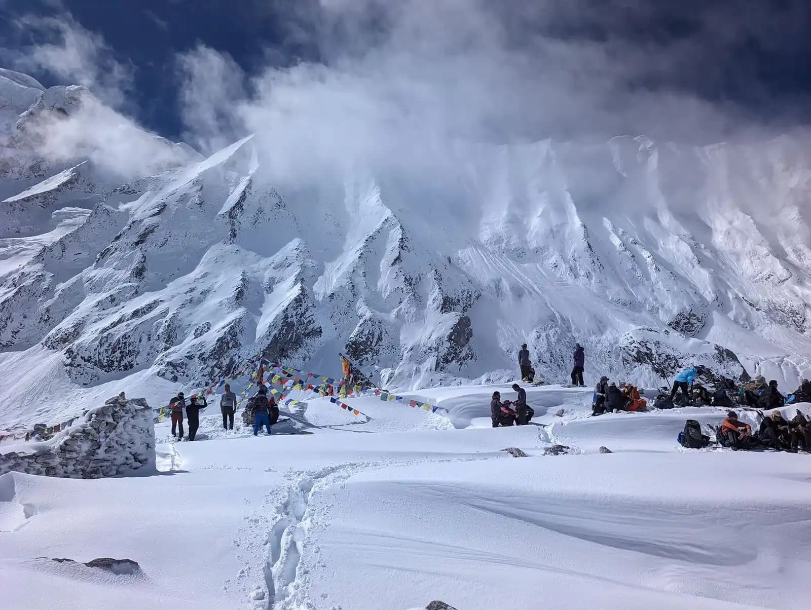
The highest point of the Manaslu Circuit Trek is the Larkya La Pass. Sitting at 5,106 meters (16,752 feet), this pass is the highlight of the journey. The crossing day is long and demanding, often taking 8-10 hours, but you are rewarded with beautiful panoramic views of the Himalayas, including Manaslu, Himlung Himal, and Cheo Himal.
Understanding the Larkya La Pass height is the first step, preparing for the thin air and potential snow conditions is the next. For a detailed look at what to expect on this day, check our guide on Manaslu Circuit Trek difficulty.
Weather and Temperature at Larkya La Pass
The weather at Larkya La Pass is very unpredictable and consistently cold due to the high elevation. Being prepared for all conditions is key to a safe crossing.
- Temperatures: During the primary trekking seasons (Spring: March-May, Autumn: October-November), daytime temperatures at the pass can range from -5°C to 5°C (23°F to 41°F). However, with wind chill, it can feel significantly colder, often well below freezing. In the early morning, temperatures can reach to -10°C to -15°C (14°F to 5°F).
- Weather Conditions: Sunny, clear mornings can quickly give way to strong winds, cloud cover, and even snow. Afternoon weather is generally less stable, which is why most groups start their crossing before dawn.
- Key Takeaway: Pack and dress in versatile, warm layers. A windproof and waterproof outer shell, insulated down jacket, thermal layers, gloves, and a warm hat are non-negotiable. Please go through our Packing List guide for all necessary packing items required.
How Long Does It Take to Cross Larkya La Pass?
The crossing of Larkya La Pass is the longest and most challenging day of the entire Manaslu Circuit Trek. Understanding the timeline helps with mental and physical preparation.
- Total Duration: Most trekkers take 7 to 10 hours to complete the full journey from Dharmasala (Larkya Phedi) to Bimthang.
- The Ascent: The climb from Dharmasala (4,460m) to the pass (5,106m) is a steep, sustained ascent of ~650 meters. This segment alone typically takes 4-5 hours. The thin air necessitates a slow, steady (slowly-slowly) pace.
- The Descent: Reaching the pass is only halfway. The descent down the other side to Bimthang (3,720m) is long, steep, taking another 3-5 hours. Trekking poles are highly recommended to reduce impact on your knees.
Altitude Sickness on the Manaslu Circuit: A Critical Guide
With the trek's highest altitude exceeding 5,100 meters, understanding and preparing for Acute Mountain Sickness (AMS) is non-negotiable for a safe experience. Travelling on the best time would reduce the risk of such problems. Visit our best time guide for full details.
What is Altitude Sickness?
Altitude Sickness (AMS) occurs when you cannot get enough oxygen from the air at high elevations. It is common above 2,500 meters (8,200 ft). Symptoms include headache, nausea, dizziness, and exhaustion. In severe, rare cases, it can progress to life-threatening conditions like High Altitude Pulmonary Edema (HAPE) or High Altitude Cerebral Edema (HACE).
Acclimatization Tips for a Safe Trek
| Tip | Why It's Important |
|---|---|
| Climb High, Sleep Low | Follow the golden rule. Hike to a higher elevation during the day, then return to a lower altitude to sleep. This primes your body for the next ascent. |
| Stay Hydrated | Drink 3-4 liters of water daily. Dehydration mimics worsens the symptoms of AMS (Acute Mountain Sickness). |
| Avoid Alcohol and Sedatives | These can depress your breathing and impair the acclimatization, especially during the first few days at altitude. |
| Know the Symptoms | Headache, nausea, dizziness, and extreme fatigue are early warning signs. Ignoring them can be dangerous. |
| Communicate with Your Guide | Your guide is trained to handle AMS. Inform them immediately of any symptoms-it's a sign of a smart trekker, not a weak one. |
Ready to Take on the Challenge?
Now that you understand the Manaslu Circuit Trek height, altitude profile, and what it takes to succeed, you're one step closer to an unforgettable Himalayan experience.
Are you ready to book your journey? Explore our expertly crafted Manaslu Trek package and let us handle the logistics for a safe and memorable adventure. Have questions about permits or a last-minute booking? Contact our team for fast and reliable support.
About Author
Amir Adhikari is the Founder and Trip Curator of Everest Thrill Trek and Expedition. With 10+ years of experience in Nepal’s competitive tourism sector, he is a recognized expert in designing safe, personalized, and high-thrill Himalayan itineraries. His dedication to responsible travel and creating authentic experiences has positioned Everest Thrill as a leading specialist for Everest, Annapurna, and off-the-beaten-path adventures.
Manaslu Circuit Trek
USD 1215/per person